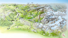
Ecrins National Park Map
Panoramic map of Parc National des Ecrins, France
1730 miles away
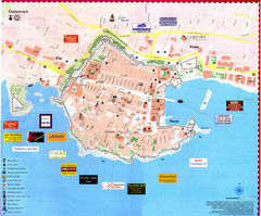
Dubrovnik Map
1839 miles away
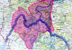
Proposed Balkans Peace Park Map
Shows the proposed Balkans Peace Park area which includes Albania to the South, Kosovo to the...
1846 miles away
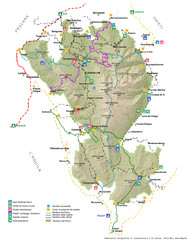
Parco Nazionale della Majella Map
General map of Majella National Park (Parco Naz. della Majella) in Italy. In Italian.
1881 miles away
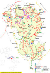
Parco Nazionale della Majella Trail Map
Trail map of Majella National Park (Parco Naz. della Majella) in Italy. Indicates under revision...
1883 miles away
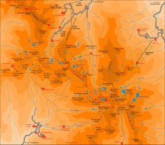
Pirin Mountains Chalet Map
Map of Pirin Mountains in Pirin National Park, near Bansko, Bulgaria. Shows peaks and mountain...
1915 miles away

Sirmilik National Park Map
Official map of Sirmilik National Park in Nunavut, Canada. Comprises Borden Peninsula, Bylot...
1946 miles away
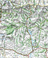
Sobrarbe Province Map
Shows Ordesa y Monte Perdido National Park and Sierra de Guara and Guara Canyons Natural Park
1952 miles away
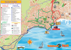
Naples Tourist Map
Tourist map of Naples, Italy. Shows bus routes.
1967 miles away
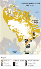
Auyuittuq National Park Map
Official map of Auyuittuq National Park. Shows glacier, emergency shelters, and warden cabins.
1967 miles away
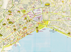
Thessaloniki Tourist Map
Map of the city center Thessaloniki, Greece showing streets, tourist sites and public buildings.
1989 miles away
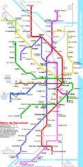
Barcelona Metro Map
2002 miles away
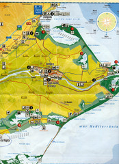
Deltebre Spain Tourist Map
Tourist Map of Deltebre, Spain and surrounding areas including the park features. Map is in...
2063 miles away
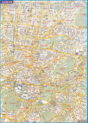
Athens City Map
City map of Athens, Greece. Scanned.
2175 miles away
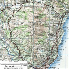
Mt Etna Topo Map
Topo map of Mount Etna in the Parco dell'Etna, Sicily. Highest mountain in Sicily at 10,902...
2179 miles away
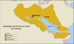
Ukkusiksalik National Park Map
Official map of Ukkusiksalik National Park in Nunavut, Canada around the Wager Bay. Shows national...
2477 miles away

Tel Aviv day map summer 2009
this is a great day map that show the real life in tel aviv , also theres a small map of "park...
2659 miles away
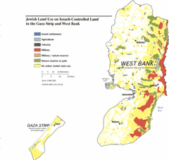
Gaza Strip and West Bank Jewish Land Use Map
2676 miles away
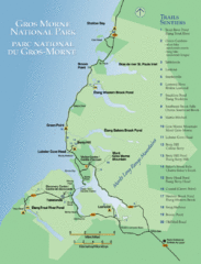
Gros Morne National Park Map
Shows campgrounds and trails in Gros Morne National Park, Newfoundland, Canada. In French and...
2734 miles away
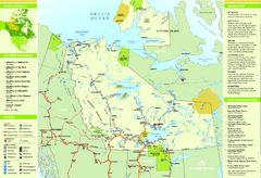
Northwest Territories Map
Overview map of Northwest Territories region, Canada
2903 miles away
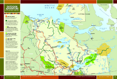
Northwest Territories Outdoor Adventure Map
Outdoor adventure map of Northwest Territories, Canada. Shows Heritage Rivers, Challenging Rivers...
2923 miles away
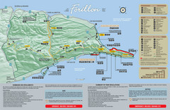
Forillon National Park Map
Official map of Forillon National Park at the tip of the Gaspe Peninsula in Quebec, Canada. Shows...
2935 miles away
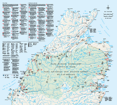
Cape Breton Highlands National Park Map
Official Parks Canada map of Cape Breton Highlands National Park, Nova Scotia. Shows hiking trails...
2964 miles away
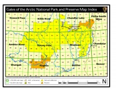
Gates of the Arctic National Park and Preserve...
Official NPS map of Gates of the Arctic National Park and Preserve in Alaska. Shows all areas. The...
2974 miles away
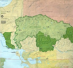
Kobuk Valley National Park and Noatak National...
NPS map of Kobuk Valley National Park and Noatak National Preserve, Alaska
2982 miles away
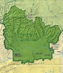
Kobuk Valley National Park Map
Official NPS map of Kobuk Valley National Park in Alaska. Kobuk Valley National Park is open year...
3003 miles away
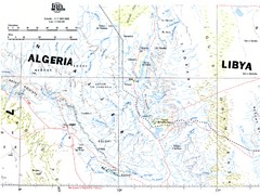
Tassili N'Ajjer National Park Map
Overview map of the Tassili N'Ajjer National Park, Algeria area. 1,000,000 scale
3057 miles away
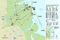
Kouchibouguac National Park Map
Official park map of Kouchibouguac National Park, New Brunswick. Shows hiking trails, services...
3072 miles away
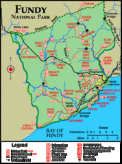
Fundy National Park Map
Official Parks Canada park map of Fundy National Park, New Brunswick. Shows trails, camping spots...
3144 miles away

Point Pleasant Park Map
Thematic Map of Point Pleasant Park with park exhibits marked. Trails and distances marked as well.
3169 miles away
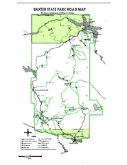
Baxter State Park overview map
Overview map of Baxter State Park. There are 46 mountain peaks and ridges, 18 of which exceed an...
3212 miles away
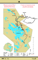
Kejimkujik National Park Map
Official Parks Canada map of Kejimkujik National Park, Nova Scotia. Shows lakes, trails, campsites...
3224 miles away
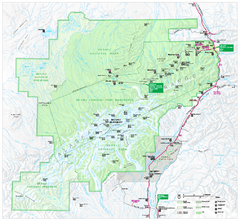
Denali National Park and Preserve map
Official NPS map of Denali National Park. Shows the entire park and surroundings. from nps.gov...
3269 miles away
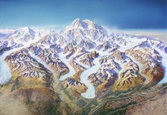
Mt. McKinley (Denali) Map
Oblique Panorama ma of Mt. Mckinley (Denali)
3279 miles away
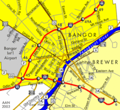
Bangor City Map
Airport, roads and interstates are on this map.
3283 miles away
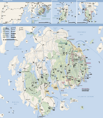
Acadia National Park Map
Official map of Acadia National Park, Maine. "Except for one mainland section, Acadia...
3299 miles away
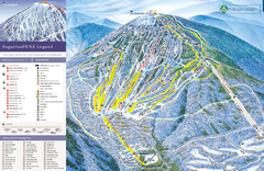
Sugarloaf Ski Trail Map
Trail map from Sugarloaf, which provides downhill, nordic, and terrain park skiing. It has 15 lifts...
3304 miles away
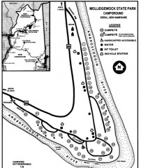
Mollidgewock State Park map
Campground map of Mollidgewock State Park in New Hampshire.
3342 miles away
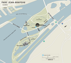
Parc Jean Drapeau Map
Park map of Parc Jean Drapeau in the St. Lawrence River, Montreal
3350 miles away
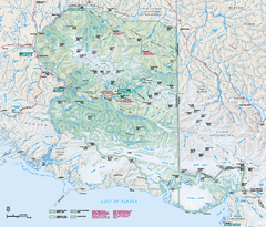
Wrangell - St Elias National Park & Preserve...
Official NPS map of Wrangell - St Elias National Park & Preserve in Alaska. The primary season...
3354 miles away

