Edit this map

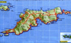
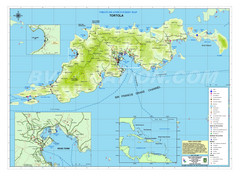
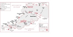
Map of Tortola Island

near tortola, british virgin islands

View LocationView Map

18.426819 -64.635487 12 satellite
Nearest Map »  Fullsize
1800 × 1164222 KBJPG

Tourist map of Tortola, the main island of the British Virgin Islands. Shows national parks and beaches.

From experiencebvi.com

C. Contillo added
Oct 17, 2007

Rating
no ratings

See an error? Report it.

Keywords

tourism, caribbean, island, beach, trellis, bay, ferris, dock, ferry, dock, trelklis, bay, tortola

0 Comments

New comments have been temporarily disabled.
See more

Nearby Maps

Tortola Island Map

Tortola Island Map

less than 1 mile away

Near Tortola Island, British Virgin Islands
Keywords: reference, island
Tortola British Islands Tourist Map

Tortola British Islands Tourist Map

Places of interest.

less than 1 mile away

Near Tortola
Keywords: tourism, hotels, parks
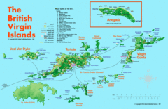
British Virgin Islands Tourist Map

British Virgin Islands Tourist Map

Tourist map of British Virgin Islands with list of major attractions

3 miles away

Near British Virgin Islands
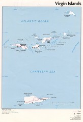
Map of the Virgin Islands

Map of the Virgin Islands

Map of the Virgin Islands

3 miles away

Near virgin islands
Keywords: tourism, island
West Tortola Driving Tour Map

West Tortola Driving Tour Map

3 miles away

Near Tortola Island, British Virgin Islands
Keywords: tourism, driving
Peter Island BVI Map

Peter Island BVI Map

7 miles away

Near peter island bvi
Keywords: reference
See more