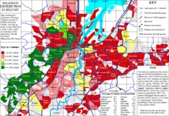
Belfast Religious Distribution Map
Guide to proportion of Catholics in each Belfast ward
0 miles away
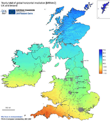
United Kingdom Solar Radiation Map
Guide to yearly total of global horizontal solar irradiation
118 miles away
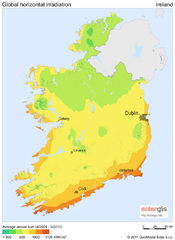
Solar Radiation Map of Ireland
Solar Radiation Map Based on high resolution Solar Radiation Database: SolarGIS. On the Solar Map...
126 miles away
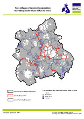
West Midlands Travel Time Statistics Map
Percentage of residents who travel to work in West Midlands, England
203 miles away
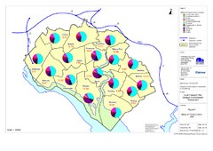
Methods of Travel in Southampton, UK Map
The methods of travel used by workers in Southampton
318 miles away
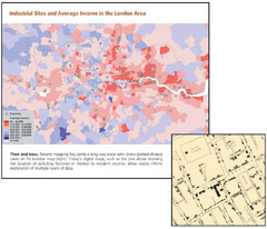
London Income and Industrial Plants Map
Map shows correllation between income and location of industrial sites. Cholera map is also...
322 miles away
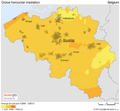
Solar Radiation Map of Belgium
Solar Radiation Map Based on high resolution Solar Radiation Database: SolarGIS. On the Solar Map...
520 miles away
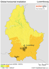
Solar Radiation Map of Luxembourg
Solar Radiation Map Based on high resolution Solar Radiation Database: SolarGIS. On the Solar Map...
607 miles away
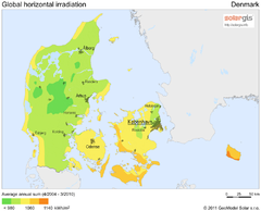
Solar Radiation Map of Denmark
Solar Radiation Map Based on high resolution Solar Radiation Database: SolarGIS. On the Solar Map...
614 miles away
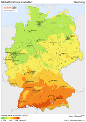
Solar Radiation Map of Germany
Solar Radiation Map Based on high resolution Solar Radiation Database: SolarGIS. On the Solar Map...
721 miles away
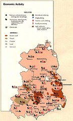
East Germany Economic Activity Map
Map of East Germany's economic activity
733 miles away
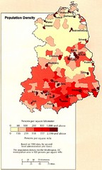
Eastern Germany Population Density Map
Map of Eastern Germany's population density
752 miles away
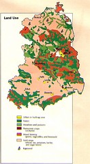
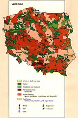
East Germany Land Use Map
Map of East Germany's land use
767 miles away
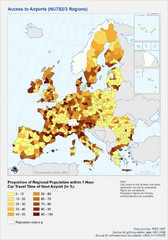
Travel Times to Airports in Europe Map
Shows proportion of car travel time to nearby airports across Western Europe
793 miles away
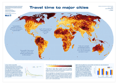
Global Map of Accessibility
European Commission has produced a gorgeous map of global accessibility to cities.
846 miles away
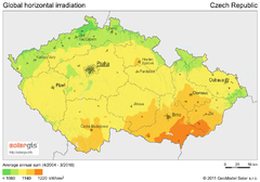
Solar Radiation Map of Czech republic
Solar Radiation Map Based on high resolution Solar Radiation Database: SolarGIS. On the Solar Map...
960 miles away
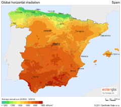
Solar Radiation Map of Spain
Solar Radiation Map Based on high resolution Solar Radiation Database: SolarGIS. On the Solar Map...
983 miles away
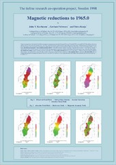
Magnetic Reductions to 1965.0 Map
Maps represent the total field magnetic anomalies of the Earth's lithosphere at the grid...
985 miles away
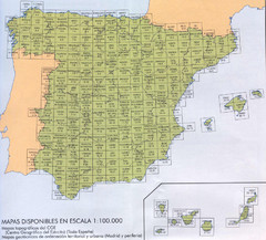
Spain's Population Topographical Map
Population in Spain's cities
992 miles away
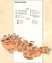
Czechoslovakia Economic Activity Map
Map of economic activity throughout region
1038 miles away
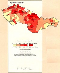
Czechoslovakia Population Density Map
Map of Czechoslovakia's population density
1039 miles away
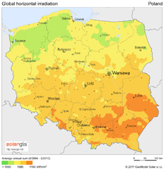
Solar Radiation Map of Poland
Solar Radiation Map Based on high resolution Solar Radiation Database: SolarGIS. On the Solar Map...
1047 miles away
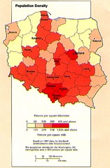
Poland Population Density Map
Map of Poland's population density
1047 miles away
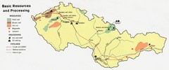
Czechoslovakia Resources Map (1974)
Map of 1974 Czechoslovakia resources
1050 miles away
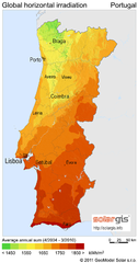
Solar Radiation Map of Portugal
Solar Radiation Map Based on high resolution Solar Radiation Database: SolarGIS. On the Solar Map...
1057 miles away

Czechoslovakia Land Use Map
Map of Czechoslovakia region land use
1057 miles away

Incidents of Tick Borne Encephalitis in Europe...
Map of Tick Borne Encephalitis Endemic Areas
1076 miles away
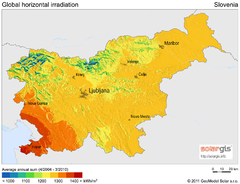
Solar Radiation Map of Slovenia
Solar Radiation Map Based on high resolution Solar Radiation Database: SolarGIS. On the Solar Map...
1085 miles away
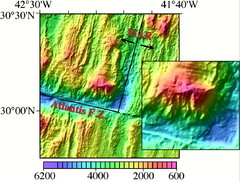
Atlantis Massif Map
The Atlantis Massif is west of the Mid-Atlantic Ridge and north of the Atlantis Fracture Zone. The...
1124 miles away
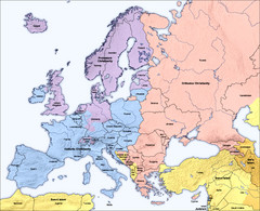
Traditional European Religious Majorities by...
Shows the traditional religious majorities by region in Europe.
1126 miles away
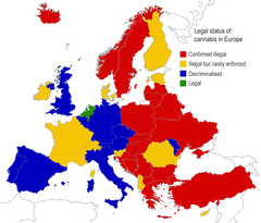
Legal Status of Cannabis in Europe Map
Shows legal status of marijuana in each European country.
1137 miles away
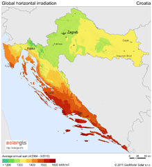
Solar Radiation Map of Croatia
Solar Radiation Map Based on high resolution Solar Radiation Database: SolarGIS. On the Solar Map...
1141 miles away
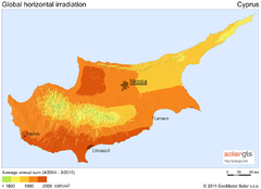
Solar Radiation Map of Cyprus
Solar Radiation Map Based on high resolution Solar Radiation Database: SolarGIS. On the Solar Map...
1141 miles away
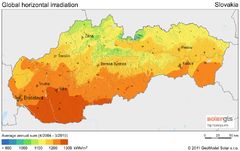
Solar Radiation Map of Slovakia
Solar Radiation Map Based on high resolution Solar Radiation Database: SolarGIS. On the Solar Map...
1165 miles away
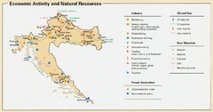
Croatia Economic Activity Map
Map of Croatia's economic activity and natural resources
1174 miles away

Croatia Historical Control Map
1174 miles away
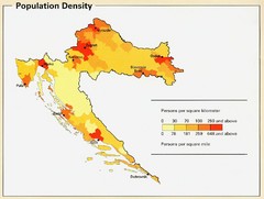
Croatia Population Density Map
Map of Croatia's population density
1183 miles away
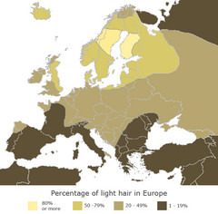
Europe Blond Hair Map
Shows percentage of light hair in Europe.
1213 miles away

