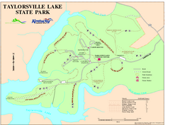
Taylorsville Lake State Park Map
Map of trails and facilities in Taylorsville Lake State Park.
0 miles away
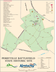
Perryville Battlefield State Historic Site Map
Map of trails and interpretive markers for the historical site of Perryville Battlefield.
26 miles away

Six Flags Kentucky Kingdom Theme Park Map
Official Park Map of Six Flags Kentucky Kingdom in Kentucky.
31 miles away
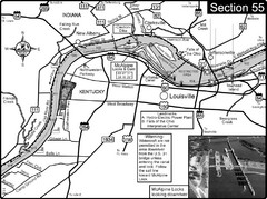
Ohio River at Louisville, KY & Southern...
This is from the Ohio River Guidebook
35 miles away
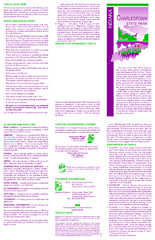
Charlestown State Park Map
37 miles away
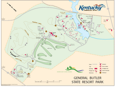
General Butler State Resort Park Map
Map of trails, facilities and golf course in General Butler State Resort Park.
47 miles away
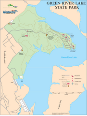
Green River Lake State Park Map
Map of trails and facilities in Green River Lake State Park.
50 miles away
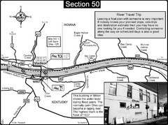
Ohio River at Madison, IN and Milton, KY Map
This is a page from the Ohio River Guidebook. The map shows important information for boaters and...
51 miles away
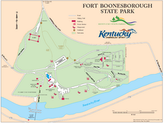
Fort Boonesborough State Park Map
Map of trails, historical sites and facilities at Fort Boonesborough State Park.
52 miles away
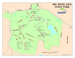
Big Bone Lick State Park Map
Map of trails and facilities for Big Bone Lick State Park.
67 miles away
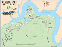
Kincaid Lake State Park Map
Map of trails, facilities and golf course in Kincaid Lake State Park.
72 miles away
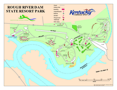
Rough River Dam State Resort Park Map
Map of trails, facilities and golf course in Rough River Dam State Resort Park.
74 miles away
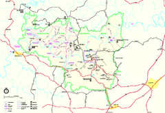
Mammoth Cave National Park Official Park Map
Official NPS map of Mammoth Cave National Park in Kentucky. Most of the park's resources and...
74 miles away
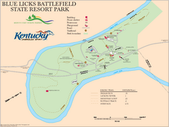
Blue Licks Battlefield State Resort Park Map
Map of Trails and Facilities in Blue Licks Battlefield State Resort Park.
75 miles away
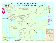
Lake Cumberland State Resort Park Map
Map of trails and facilities for Lake Cumberland State Resort Park.
76 miles away
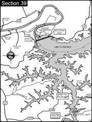
Lake Cumberland-Cumberland River Map
Lake Cumberland is formed by a dam on the Cumberland River in Section 39 of the Cumberland River...
78 miles away
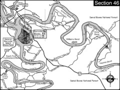
Burnside, KY-Cumberland River Map
Burnside, Kentucky is located at the fork of the Cumberland River and the South Fork. This is...
78 miles away
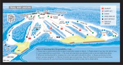
Paoli Peaks Ski Trail Map
Official ski trail map of Paoli Peaks ski area from the 2007-2008 season.
79 miles away
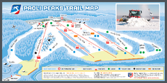
Paoli Peaks Ski Trail Map
Trail map from Paoli Peaks, which provides downhill, night, and terrain park skiing. It has 8 lifts...
79 miles away
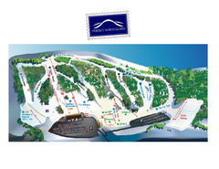
Perfect North Slopes Ski Trail Map
Trail map from Perfect North Slopes, which provides downhill, nordic, and terrain park skiing. It...
82 miles away
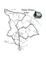
Stone House Trail Map
85 miles away
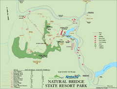
Natural Bridge State Resort Park map
Recreation map for Natural Bridge State Park in Kentucky
86 miles away

Coney Island Amusement Park Map
Amusement park map. 513-232-8230
86 miles away
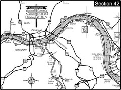
Ohio River at Cincinnati, Ohio and Newport, KY Map
This is a page from the Ohio River Guidebook. The map shows important information for boaters and...
87 miles away
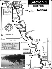
Columbus, IN White River East Fork Map
This is a page from the White River Guidebook. The map shows important information for boaters and...
90 miles away
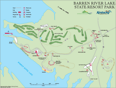
Barren River State Park map
Recreation map for Barren River Lake State Park in Kentucky
90 miles away
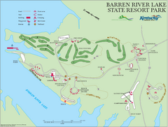
Barren River Lake State Resort Park Map
Map of facilities and golf course in Barren River Lake State Resort Park.
91 miles away
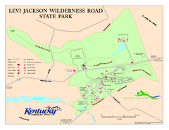
Levi Jackson Wilderness Road State Park Map
Map of trails and facilities of Levi Jackson Wilderness Road State Park.
91 miles away
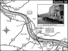
Ohio River at Maysville, Kentucky Map
This is a page from the Ohio River Guidebook. The map shows important information for boaters and...
91 miles away
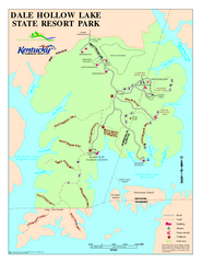
Dale Hollow Lake State Park Map
Map of trails and facilities of Dale Hollow Lake State Park.
93 miles away
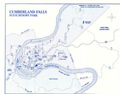
Cumberland Falls State Resort Park Map
Cumberland Falls Park Area Map
93 miles away
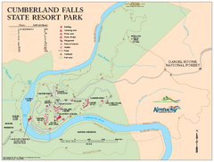
Cumberland Falls State Resort Park map
Detailed recreation map for Cumberland Falls State Resort Park in Kentucky
93 miles away
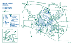
East Fork State Park map
Detailed recreation map for East Fork State Park in Ohio
94 miles away
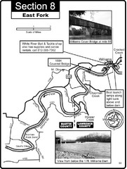
Williams, IN White River East Fork Map
This is a page from the White River Guidebook. The map shows important information for boaters and...
95 miles away
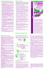
Brown County State Park, Indiana Site Map
96 miles away
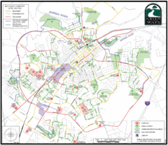
Bowling Green Biking Map
Map of biking trails in the city of Bowling Green area. Includes all streets, parks, some buildings...
97 miles away
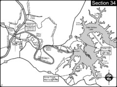
Celina, TN Dale Hollow Lake-Cumberland River Map
Celina Tennessee is the location for the head of navigation for the Cumberland River at the fork of...
101 miles away
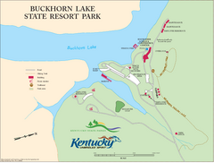
Buckhorn Lake State Resort Park Map
Map of Trails and Facilities of Buckhorn Lake State Resort Park.
106 miles away
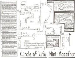
Circle of Life Mini-Marathon Map
Detailed Hand-Drawn Course for Circle of Life Mini-Marathon Map
107 miles away
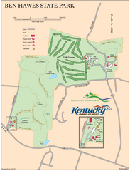
Ben Hawes State Park Map
Map of trails, facilities and golf course in Ben Hawes State Park.
107 miles away

