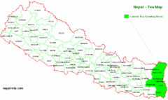
Nepal Tea Growing Regions Map
0 miles away
Near Nepal
887 × 529•18 KB•GIF
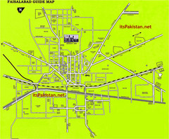
Faisalabad Road Map
This is a map of Faisalabad Pakistan showing important places of Faisalabad and main roads
694 miles away
Near Faisalabad
1502 × 1238•448 KB•JPG
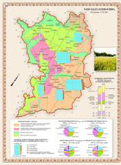
Karabakh Map
Agriculture of the Nagorno-Karabakh Republic (Artsakh)
2354 miles away
Near Armenia
803 × 1093•770 KB•JPG
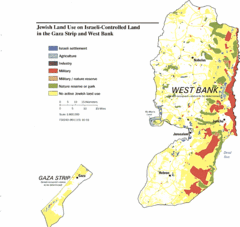
Gaza Strip and West Bank Jewish Land Use Map
2923 miles away
Near West Bank, Israel
2288 × 2168•230 KB•GIF
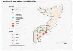
Somalia Land Use Map
Map of Somalia's agricultural land use and natural resources
2960 miles away
Near Somalia
1419 × 993•125 KB•JPG
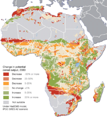
Projected climate change impacts for agriculture...
Africa is one of the regions that will be hit the hardest by climate change, and it will likely...
4641 miles away
Near africa
950 × 1035•198 KB•PNG

Wheatbelt Central Western Australia Map
Map of the central wheatbelt area near Merredin, Western Australia
4713 miles away
Near Merredin, WA
1672 × 1333•513 KB•GIF
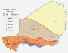
Niger 1969 Economic Activity Map
Guide to the economic activity of Niger in 1969
4771 miles away
Near Niger, Africa
1275 × 983•203 KB•JPG
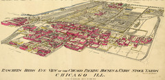
Chicago Meatpacking District and Stockyards (1890...
Charles Rascher's illustration of the Chicago meatpacking district in 1890.
7566 miles away
Near 41.816, -87.657
3999 × 1934•1.8 MB•JPG
page 1 of 1

