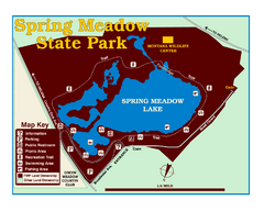
Spring Meadow Lake State Park Map
This urban, day-use-only park minutes from Helena fed by natural springs, is a popular spot for...
Near Spring Meadow Lake State Park, MT, USA
643 KB•PDF
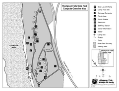
Thompson Falls State Park Map
This shaded, quiet campground is located on the Clark Fork River near the town of Thompson Falls in...
Near Thompson Falls State Park, MT, USA
232 KB•PDF
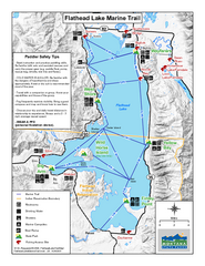
West Shore State Park Map
Glacially carved rock outcrops rise from Flathead Lake to overlooks with spectacular views of the...
Near West Shore State Park, MT, USA
1.1 MB•PDF
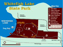
Whitefish Lake State Park Map
Although it’s right on the outskirts of Whitefish, this small park provides a mature forest...
Near Whitefish Lake State Park, MT, USA
433 KB•PDF
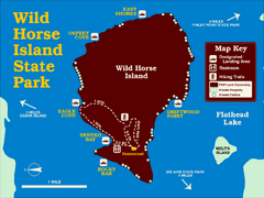
Wild Horse Island State Park Map
Boat access to this day-use-only, primitive park is regulated to protect the 2,000-acre island. The...
Near Flathead Lake State Park Wild Horse, MT, USA
1016 KB•PDF
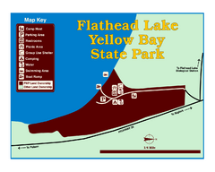
Yellow Bay State Park Map
Yellow Bay is in the heart of the famous Montana sweet cherry orchards, blossoms color the...
Near Kallispell, MT, USA
429 KB•PDF
page 2 of 2

