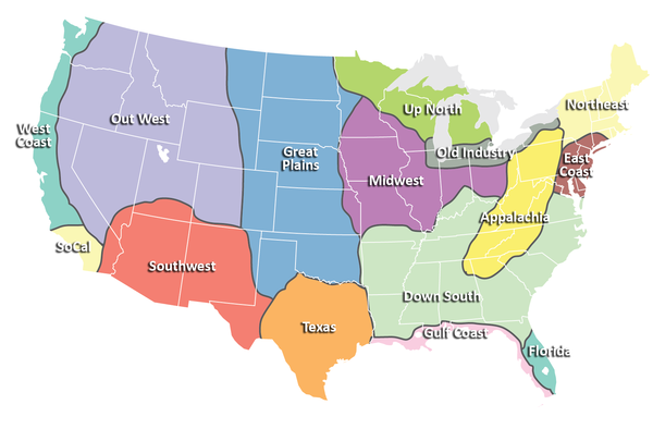
Regions of the United States Map
near united states
View Location
Appalachia- Hills, hills and more hills. Appalachian landforms contribute to landscapes of isolation, and really cool meandering settlement patterns that I always find fascinating when driving through or when flying over. Isolation, though, has brought tremendous poverty and really, really good music (and by this, I am talking about bluegrass). Down South- A sort of compilation of the leftovers of the old Confederate States of America, once you surgically remove Appalachia's southern reaches, and then hack off Texas, the Gulf Coast and Florida. Is this assumption outdated? Sure, I have no doubt. It's kind of a catch-all region for places with a broadly shared cultural identity. At the risk of insulting the technological center in the Triangle of North Carolina and the tourist areas of the coast, my mind still lumps this all together even though I know better. To the old CSA, I've added part of Kentucky and the southern portions of Missouri, Indiana and Ohio, where many people are seemingly still proud to fly Dixie's flags. East Coast- I know, tiniest region ever, right? And not terribly accurate in its description. In my mind, most of that Acela corridor fits together, with the urban areas of NYC, Philly, DC and Baltimore. It's mostly urbanized, and this region is probably the urban epicenter of the country. Then again, when you go north of suburban Connecticut, to me it seems more a part of the "Northeast." Florida- Most of peninsular Florida has managed to distinguish itself culturally, in my mind, from the remainder of the south. Any Floridian will tell you that Florida's two coasts have drastically different characteristics. I've grouped most of Florida with the Atlantic coast, because I feel like the character of Florida's gulf coast is far more similar to neighboring areas in Alabama and Mississippi. Great Plains- On a clear day in Topeka, you can see the Rockies, right? Well, not really, but it sure seems like it should be true if you've ever taken I-70 west of the Kansas state capital to Denver. In some ways, the Great Plains are one of the most breathtaking regions in the United States in terms of physiography, simply because of their vastness. The region's largely flat in topography, semi-arid in climate, and primary sector (agriculture and petroleum) in economy. Settlement is sparse, to where tiny tiny towns have an incredible level of importance and provide many more services than a town of similar population back east. Gulf Coast - The Gulf Coast, from the Everglades through the Texas border, are far more marshy than the Atlantic coast. Waves are (typically) calmer, and the resort communities seem to be a slower pace. Mobile's a nice city, and New Orleans is unique to the world. Midwest- A lot of people debate over where the midwest is. To me, it has one major thing in common, and that's an agricultural landscape. Sure, there are cities there, and many of these cities have significant industrial capacities. By and large, though, this is a predominantly rural area with active farming, including dairy, livestock, grain and fruit. Farm sizes aren't nearly as large as the big wheat farms and ranches of the plains, though they may approach 600 acres in the midwest. This is my homeland, and driving there from NE Ohio to see my parents, I always get a little bit of warmth in my belly when we pass Mansfield, the land flattens out, and the trees disappear in favor of farm fields. Northeast- This is, admittedly, my least traveled region in the continental US. I've never been to New Hampshire or Maine, and that's pitiful, I admit. I've only been to Massachusetts twice, and only through a tiny portion of Vermont on a train. Possibly because I am less familiar with this area, it all gets lumped together in my head as being the Northeast. Old Industry- Some would call this the Great Lakes, but I always found that definition a little odd because a huge portion of the Great Lakes has nothing to do with this area (see "Up North"). This is an old industrial belt that borders the southern edge of the Great Lakes, from Milwaukee to Syracuse. Not all of it was industrialized, but most of it was at one time, and most of it is also transitioning out of those industrial economies to other use. Some of the more striking landscapes in the United States are the industrial wastelands of this region, factories that undoubtedly cost millions upon millions of dollars to construct that now apparently aren't worth owning at all. Out West- It's a huge region on my map, and maybe for good reason. This was the prime area we'd explore when my mom would take us on the field camps she led when we were kids. My brother and I would always talk about those trips as going "Out West" and the name has always stuck with me. It's probably my favorite region of the country to visit, and I'd love to live there, amongst the incredible scenic beauty of the Rockies, or even the desolate majesty of the Great Basin. SoCal- California's diverse enough that you could split it into seven regions or twenty and maybe still fail to do it justice. It's an amazing place. One region of that state that must be set aside is SoCal (Southern California) because of its distinct Mediterranean style climate, it's unique style of sprawling urbanism, its many cultural influences, and its rich economic engines. Southwest- Dry, hot, beautiful in its sparseness, and large influences from Hispanic and Native American cultures. I'll never forget camping at a teacher's property on the Hopi reservation, using the world's most decrepit outhouse in the middle of the night and having a cool desert breeze blow the door open (the latch was broken) as I sat there pooping, treating me to one of the most glorious views of a starry night sky I've ever seen in my life, all dimly illuminating the second mesa in the distance. Texas- Texans firmly believe that they live in their own country. In some weird ways, Texas seems a lot like Canada... basically America but with their own way of doing those American-style things. In Canada, that means universal healthcare. In Texas, that means giant 4,000 square foot houses with Texas-shaped swimming pools in the back yard, all selling for $150,000. Oh, and guns... lots of guns. The lesson here is clear: Don't Mess with Texas. Up North- Lots of conifer trees and cold-ass winters. People seem to only come up here if they like hunting or fishing, snowmobiling or other winter activities. Beautiful place, and maybe one of the last true wildernesses in the eastern half of the US, but lonely and very, very cold. West Coast- Rainy, foggy, mild, progressive and absolutely beautiful. Three great metropolises -- San Francisco, Portland and Seattle -- that rival those in any other region. The coast of northern California through Seattle may be some of the most glorious coastline ever to exist.
Nearby Maps
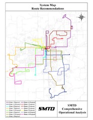
Lincoln Bus Map
41 miles away
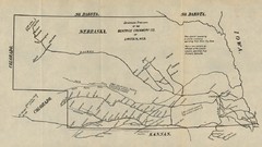
Skimming Stations of the Beatrice Creamery...
"Skimming Stations of the Beatrice Creamery Co. of Lincoln, Neb." From Report of the...
41 miles away
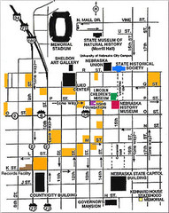
Downtown Lincoln, Nebraska Map
Red is the Nebraska History Museum. School bus parking is on the west side of 15th Street in front...
41 miles away
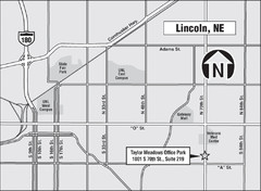
Lincoln, Nebraska Map
41 miles away
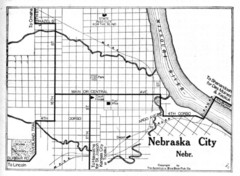
Nebraska City 1920 Map
42 miles away
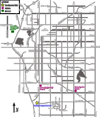
Lincoln, Nebraska City Map
42 miles away

 click for
 Fullsize

0 Comments
New comments have been temporarily disabled.