Kozienice_County_Poland_Streetmap.jpg Map
near Kozienice, pl
View Location
 click for
 Fullsize
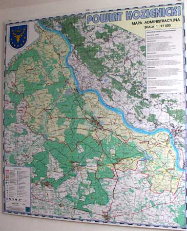
Street Map of Kozienice_County_Poland_Streetmap.jpg is added here because of the interesting wooden frame enclosed the map of Kozienice District, Mazovia, Poland. Sometimes well done frame makes a map more interesting.
 EDGAR
EDGARNearby Maps

Kocienice_City_Plan-POLAND Map
Plan of City of Kozienice, PL
less than 1 mile away

Kozienice_County_wall_map Map
Kozienice County big size wall map Covers all 7 communes: Kozienice, Garbatka-Letnisko, Grabow nad...
2 miles away

Brzoza_Glowaczow_Poland - 2000 x 1250.PNG Map
Map of Brzoza_Glowaczow_Poland - 2000 x 1250.PNG is special project dedicated to school in Brzoza...
7 miles away

RadomkaRiver-kayaking Map
Radomka River - kayaking map Checked on field and verified map of Radomka River from Brzoza to...
8 miles away

Garbatka_Letnisko_Poland.jpg Map
Map of Garbatka_Letnisko_Poland.jpg is a "city-village" plan. I do love to enter photos...
8 miles away

Sieciechow commune street map, PL Map
Sieciechow commune - street map Ed. 2007 Size 2000 x 1000 mm Type: administratie and touristic map
9 miles away

0 Comments
New comments have been temporarily disabled.