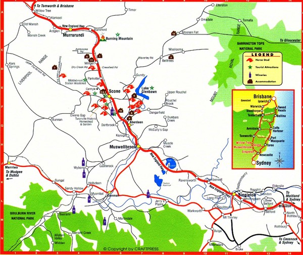
Upper Hunter Valley Tourist Map
near Muswellbrook, NSW
View Location
Tourist map of Upper Hunter Valley around Muswellbrook, NSW, Australia. Shows horse studs, tourist attractions, wineries, and accommodations.
See more

 See more
Nearby Maps

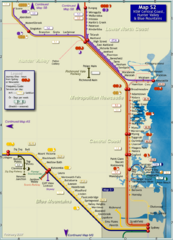
Hunter Valley Rail Map
Map of rail system throughout Hunter Valley, New South Wales Central Coast, and Blue Mountains
52 miles away
Near Hunter Valley, Australia

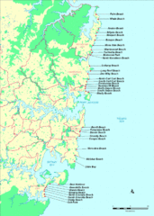
New South Wales, Australia Beach Tourist Map
59 miles away
Near NSW Australia

The Great North Walk Trail Map
The Great North Walk connects New South Wales’ two largest cities from the obelisk in...
61 miles away
Near Australia

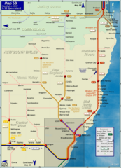
Northern New South Wales Map
Map of long-distance rail system throughout New South Wales and South East Queensland
63 miles away
Near Northern New South Wales, Australia

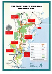
Great North Walk 100s Overview Map
Trail map for the Great North Walk 100's with distances and checkpoints marked
67 miles away
Near Newcastle, Austraila

 click for
 Fullsize


0 Comments
New comments have been temporarily disabled.