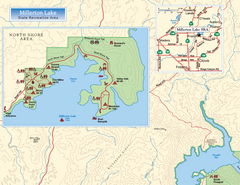
Millerton Lake State Recreation Area NE Map
near 5290 Millerton Road, Friant, CA
View Location
Click “View fullsize” below to see the map.
37.0418873971657
-119.616565704346
13
satellite
Map of NE region of park with detail of trails and recreation zones
See more
 See more
Nearby Maps

Millerton Lake State Recreation Area NW Map
Map of NW region of park with detail of trails and recreation zones
less than 1 mile away
Near 5290 Millerton Road, Friant, CA

Millerton Lake State Recreation Area Campground...
Map of campground region of park with detail of trails and recreation zones
less than 1 mile away
Near 5290 Millerton Road, Friant, CA

Millerton Lake State Recreation Area SE Map
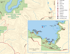
Map of SE region of park with detail of trails and recreation zones
less than 1 mile away
Near 5290 Millerton Road, Friant, CA

Millerton Lake State Recreation Area SW Map
Map of SW region of park with detail of trails and recreation zones
less than 1 mile away
Near 5290 Millerton Road, Friant, CA

Millerton Lake State Recreation Area Map
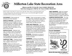
Map of park with detail of trails and recreation zones
less than 1 mile away
Near 5290 Millerton Road, Friant, CA

Millerton Lake State Recreation Area Park Map
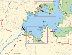
Map of park with detail of trails and recreation zones
less than 1 mile away
Near 5290 Millerton Road, Friant, CA

 Fullsize

0 Comments
New comments have been temporarily disabled.