Edit this map

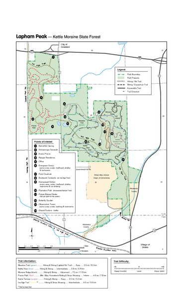
Lapham Peak Map

near Lapham Peak, WI, USA

View LocationView Map

43.040558 -88.400209 17 satellite
Nearest Map »  Fullsize
484 KBPDF

Ranger residence, hike path, restrooms and more are clearly marked upon this map.

From Wisconsin Department of Natural Resources

Chris added
Jun 21, 2009

Rating
rated 5 by 1 person

See an error? Report it.

Keywords

tourism, tourist, guide, walk, shopping, hike, water, waterfalls, river, picnic, vacaction, fun, map, bridge

0 Comments

New comments have been temporarily disabled.
See more

Nearby Maps

Chippewa Morraine State Park Map

Chippewa Morraine State Park Map

Walking trails.

6 miles away

Near Chippewa Morraine, WI, USA
Jefferson County, Wisconsin Map

Jefferson County, Wisconsin Map

Map of Jefferson County, includes detailed information on streets, highways, recreational...

16 miles away

Near Jefferson County, Wisconsin, USA
Keywords: tourism, lakes, milage
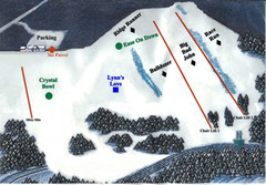
Crystal Ridge Ski Area Ski Trail Map

Crystal Ridge Ski Area Ski Trail Map

Trail map from Crystal Ridge Ski Area.

21 miles away

Near 7900 W Crystal Ridge Dr, Franklin, WI‎
Alpine Valley Resort Ski Trail Map

Alpine Valley Resort Ski Trail Map

Trail map from Alpine Valley Resort.

21 miles away

Near East Troy, Wisconsin, United States
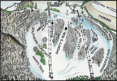
Little Switzerland Back Ski Trail Map

Little Switzerland Back Ski Trail Map

Trail map from Little Switzerland.

22 miles away

Near 105 Cedar Creek Rd, Slinger, WI‎
Mequon City Map

Mequon City Map

City map of Mequon, Wisconsin

25 miles away

Near Mequon, Wisconsin
Keywords: reference
See more