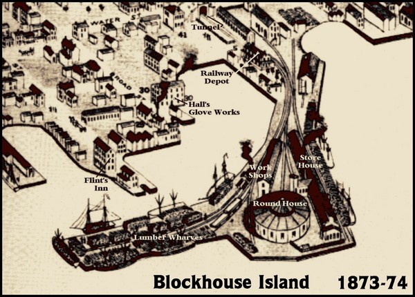
Blockhouse Island Map 1874
near Brockville, Ontario
View Location
Bird’s Eye view map of Brockville created by artist Herman Brosius and the lithographers employed by the Charles Shober & Co of Chicago.
See more

 See more
Nearby Maps

Ogdensburg, New York Historical Map
A wonderful highlight are the art reproductions of homes and buildings which surround the map...
13 miles away
Near ogdensburg

Lower Beverely Park Map
22 miles away
Near Lower Beverely Park Road Ontario

Wellesley Island Illustrated Map
Colorized illustration from "Thousand Islands" viewbook.
24 miles away
Near wellesley island

Dry Hill Ski Area Ski Trail Map
Trail map from Dry Hill Ski Area.
46 miles away
Near 23682 County Route 67, Watertown, NY

Olympic Scenic Byway Map
Overview map showing the length of the Olympic Scenic Byway, which runs from Lake Ontario (Sackett...
51 miles away
Near watertown, new york

 click for
 Fullsize


0 Comments
New comments have been temporarily disabled.