Ohio maps
Top Contributors..
-
5

nava
-
2

RiversRme
-
1
FadedMemory
-
1

BigMapBlog
Claim the World, Map by Map
Claim a country by adding the most maps.Celebrate your territory with a Leader’s Boast.
Become World Leader by claiming the most!
Ohio Cities by Map Count..
- 5Columbus maps
- 4Toledo maps
- 3Cincinnati maps
- 2Akron maps
- 2Athens maps
- 2Bellefontaine maps
- 2Brecksville maps
- 2Dayton maps
- 2Springfield maps
- 1Adelphi map
- 1Ashland map
- 1Ashtabula map
- 1Aurora map
- 1Avon map
- 1Batavia map
- 1Blacklick map
- 1Bowling Green map
- 1Buckeye Lake map
- 1Caledonia map
- 1Canton map
- 1Castalia map
- 1Celina map
- 1Centerburg map
- 1Chesterland map
- 1Chillicothe map
- 1Cleveland map
- 1Cortland map
- 1East Cleveland map
- 1Fairview Park map
- 1Fort Recovery map
- 1Fort Thomas map
- 1Grand Rapids map
- 1Greenfield map
- 1Groveport map
- 1Hamilton map
- 1Holland map
- 1Huntsville map
- 1Kilbourne map
- 1Lebanon map
- 1Loudonville map
- 1Loveland map
- 1Maineville map
- 1Mansfield map
- 1Marengo map
- 1Maumee map
- 1Middletown map
- 1Minster map
- 1Newark map
- 1Old Washington map
- 1Oregon map
1 2
Related Info
Ohio Keywords
airports amusement park beaches biking boating camping campus canoeing charts cities city college country entertainment environment europe fishing hiking island lake map memorial monument mountains museum national park navigation of park parking parks railroad restaurants river river maps rivers road roads school scotland ski area skiing sport state state park states subway theme park tourism tourist trail trails transit united united states university walk water wildlife zoo
Ohio Maps

Lake Hope State Park map
Detailed recreation map for Lake Hope State Park in Ohio
Near McArthur, OH 45651

Lake Loramie State Park map
Detailed recreational map for Lake Loramie State Park in Ohio
Near Minster, Ohio 45865-9311

Lake Metroparks Fishing Map
Near Near Cleveland

Little Miami Scenic Trail Map
Map of the Little Miami Scenic Trail biking route from Xenia, Ohio to Yellow Springs, Ohio...
Near Xenia, Ohio

Little Miami State Park map
Detailed recreation map for Little Miami State Park and surrounding area in Ohio
Near 8570 East State Route 73, Waynesville, Ohio...

Maumee Bay State Park Map
Near Maumee Bay State Park

Mohican State Park map
Detailed recreation map for Mohican State Park in Ohio
Near Loudonville, Ohio 44842

Mosquito Lake State Park map
Detailed recreation map for Mosquito Lake State Park in Ohio
Near Cortland, Ohio 44410-9303

NASA Glenn Research Center Location Map
Near 21000 Brookpark Road, Cleveland, OH 44135

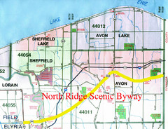
North Ridge Byway Map
The North Ridge Scenic Byway runs along Ohio State Route 254 in Lorain County, Ohio. Variously...
Near Avon, Ohio

Oak Openings Metropark Map
Near toledo, oh

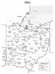
Ohio Airports Map
Near Ohio

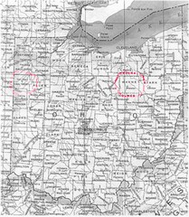
Ohio Counties Map
Near Ohio

Ohio County Map
Near Ohio

Ohio EPA Subwatersheds Boundaries in Darby...
Map shows watersheds by colors for West Central Ohio
Near Columbus, Ohio

Ohio River at Marietta, OH and 8 miles...
This is a page from the Ohio River Guidebook. The map shows important information for boaters...


 Maps contributed
 Big Map
  Gallery


