New Hampshire maps
Top Contributors..
-
2

nava
-
1

Brigid
-
1
FadedMemory
Claim the World, Map by Map
Claim a country by adding the most maps.Celebrate your territory with a Leader’s Boast.
Become World Leader by claiming the most!
New Hampshire Cities by Map Count..
- 6Waterville Valley maps
- 3Danbury maps
- 2Bartlett maps
- 2Center Conway maps
- 2Concord maps
- 2Eaton Center maps
- 2Francestown maps
- 2Franconia maps
- 2Gorham maps
- 2Hampton maps
- 2Hanover maps
- 2Jackson maps
- 2Jaffrey maps
- 2Laconia maps
- 2Lincoln maps
- 2Lyme maps
- 2Manchester maps
- 2Newbury maps
- 2Suncook maps
- 1Belmont map
- 1Bethlehem map
- 1Canaan map
- 1Durham map
- 1Easton map
- 1Enfield map
- 1Errol map
- 1Exeter map
- 1Hebron map
- 1Henniker map
- 1Hillsboro map
- 1Keene map
- 1Merrimack map
- 1Milan map
- 1Nashua map
- 1Peterborough map
- 1Plymouth map
- 1Twin Mountain map
- 1Washington map
- 1Wentworth map
- 1Wilton map
- 1Windsor map
- 0Hampton maps
- 0Lunenburg maps
- 0North Conway maps
- 0Wolfeboro Falls maps
Related Info
New Hampshire Keywords
- academy airports amenities atlantic boarding school boating campground camping campus cardigan college conservation country cross cross country skiing downhill east elevation england exeter fairfield fishing for high school hiking ivy league lebanon map mountain mountains mt new niehues nordic open space park parks phillips public public land recreation reference rivers road roads saint side ski area skiing snowmobiling snowshoeing state park temple topo tourism town trail trails university
New Hampshire Maps
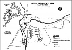
Moose Brook State Park map
Campground map of Moose Brook State Park in New Hampshire.
Near Gorham, NH
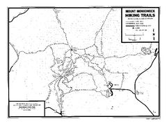
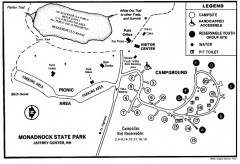
Mount Monadnock State Park Map
Official hiking map of the park. With its thousands of acres of protected highlands, 3,165...
Near Jaffrey, New Hampshire

Mount Sunapee Ski Area Ski Trail Map
Trail map from Mount Sunapee Ski Area.
Near Newbury, New Hampshire, United States

Mt. Sunapee Ski Trail Map
Official ski trail map of Mt. Sunapee ski area from the 2007-2008 season.
Near Route 103, Newbury, NH 03255

Mt. Washington Valley Restaurant Guide Map
Restaurants in Mt. Washington Valley, New Hampshire
Near Mt. Washington Valley, New Hampshire

New Hampshire Airports Map
Near New Hampshire
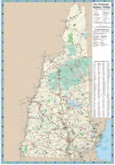
New Hampshire Boating and Fishing Public Access...
Shows public access boating and fishing sites and depth maps for state of New Hampshire
Near New Hampshire

New Hampshire Counties Map
Near New Hampshire

Peterborough Open Space Map
Map of open space lands in Peterborough, New Hampshire
Near Peterborough, New Hampshire

Ragged Mountain Ski trail Map
Official ski trail map of Ragged Mountain ski area from the 2007-2008 season.
Near 620 Ragged Mountain Road, Danbury, NH 03230

Ragged Mountain Ski Trail Map
Trail map from Ragged Mountain.
Near Danbury, New Hampshire, United States

Ragged Mountain Ski Trail Map
Trail map from Ragged Mountain.
Near Danbury, New Hampshire, United States

Temple Mountain Last year open—Credited to...
Trail map from Temple Mountain. This ski area opened in 1937.
Near Belmont, New Hampshire, United States
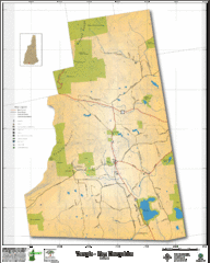
Temple NH Topo Map
Topographical map of Temple, NH area. Shows all roads and points of interest.
Near Temple, NH


 Maps contributed
 Big Map
  Gallery