Georgia maps
Top Contributors..
Claim the World, Map by Map
Claim a country by adding the most maps.Celebrate your territory with a Leader’s Boast.
Become World Leader by claiming the most!
Georgia Cities by Map Count..
- 8Atlanta maps
- 5Athens maps
- 3Augusta maps
- 3Dublin maps
- 3Helena maps
- 2College Park maps
- 2Statesboro maps
- 2Winder maps
- 1Albany map
- 1Austell map
- 1Blakely map
- 1Carrollton map
- 1Cartersville map
- 1Chatsworth map
- 1Clayton map
- 1Crawfordville map
- 1Decatur map
- 1Douglas map
- 1Eastman map
- 1Ellenton map
- 1Flovilla map
- 1Flowery Branch map
- 1Fort Gaines map
- 1Fort Oglethorpe map
- 1Hartwell map
- 1Hephzibah map
- 1Hoboken map
- 1Jefferson map
- 1Kennesaw map
- 1Lithonia map
- 1Marietta map
- 1Milledgeville map
- 1Mitchell map
- 1Montgomery map
- 1Mount Carmel map
- 1Mountain City map
- 1North Druid Hills map
- 1Oakwood map
- 1Omaha map
- 1Perkins map
- 1Pine Mountain map
- 1Pinehurst map
- 1Reidsville map
- 1Rising Fawn map
- 1Rutledge map
- 1Savannah map
- 1Skidaway Island map
- 1Stone Mountain map
- 1Summerville map
- 1Thunderbolt map
Related Info
Georgia Keywords
Georgia Maps

Chickamauga & Chattanooga National Military...
Official NPS map of Chickamauga & Chattanooga National Military Park in Georgia. All units...

Cloudland Canyon State Park Map
Map of park with detail of trails and recreation zones

Crooked River State Park Map
Map of park with detail of trails and recreation zones

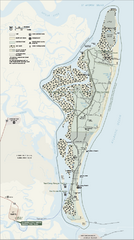
Cumberland Island Map
Map of Cumberland Island, including hiking trails and campgrounds

Cumberland Island National Seashore Map
Official NPS map of Cumberland Island National Seashore, Cumberland Island, Georgia. Rated #4...

Darton College Campus Map

Davidson-Arabia Mountain Nature Preserve Map
Davidson-Arabia Mountain Nature Preserve is comprised of 570 acres of granite outcrop, wetlands...

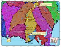
Drainage Basins of the Southeast United States...
Lakes, rivers and dams in the Apalachicola, Chattahoochee and Flint River System.

F.D. Roosevelt State Park Map
Map of park with detail of trails and recreation zones

Florence Marina State Park Map
Map of park with detail of trails and recreation zones

Fort McAllister Historic Park Map
Map of park with detail of trails and recreation zones

Fort Mountain State Park Map
Map of park with detail of trails and recreation zones

Fort Yargo State Park map
Detailed recreation and camping map for Fort Yargo State Park in Georgia

Fort Yargo State Park Map
Map of park with detail of trails and recreation zones

General Coffee State Park Map
Map of park with detail of trails and recreation zones

George L. Smith State Park Map
Map of park with detail of trails and recreation zones

George T. Bagby State Park Map
Map of park with detail of trails and recreation zones

Georgia College Campus Map
Georgia College Campus Map. Shows all areas.


 Maps contributed
 Big Map
  Gallery
