Edit this map

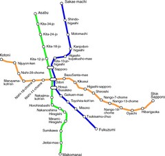
Sappora Subway Map

near sappora

View LocationView Map

43.0620958 141.3543763 10 satellite
Nearest Map »  Fullsize
800 × 54585 KBPNG

Clear map of Sappora's subway system.

From upload.wikimedia.org

Chris added
Oct 12, 2009

Rating
no ratings

See an error? Report it.

Keywords

transportation, subway, metro, muni, transporation

0 Comments

New comments have been temporarily disabled.
.
See more

Nearby Maps

Sapporo Metro Map

Sapporo Metro Map

Simple map of Sapporo's metro system.

0 miles away

Near Sapporo
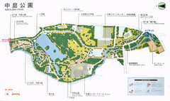
Nakajima Park Map

Nakajima Park Map

1 mile away

Near Sapporo
Keywords: tourism, parks
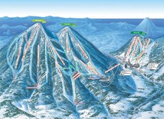
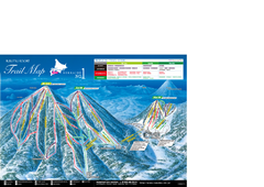
Rusutsu Resort Ski Trail Map

Rusutsu Resort Ski Trail Map

Trail map from Rusutsu Resort, which provides downhill skiing. This ski area has its own website.

33 miles away

Near Hokkaidō, Japan
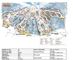
Rusutu Trail Map

Rusutu Trail Map

Simple map marking trails and peaks.

33 miles away

rated 4 by 1 person
Near rusutu, japan
Niseko Ski Resort Map

Niseko Ski Resort Map

Niseko's Mt. An'nupuri is home to three major ski resots: Niseko Grand Hirafu, Niseko...

38 miles away

rated 4 by 1 person
Near niseko, japan
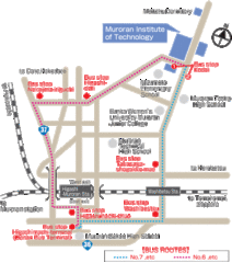
Muroran Institute of Technology Campus Map

Muroran Institute of Technology Campus Map

Simple and clear map of this small campus.

53 miles away

Near Muroran, Hokkaidō, Japan
See more